The Yaak is a contradictory place, equal parts obscuring temperate forest and friendly eroded hills. The few spiky places in the landscape draw your eye from miles and miles away. Satellite photos reveal glacial history in series, scalloped ridges, whose pattern and line pull from afar, but on the ground, in a fire lookout, atop a gentle mountain out at the end, history is subsumed in an endless rolling of green. The alpines select intrusion here is not noticeable on the basis of elevation, as sinuousity bends peaks down and shows how small along the curve of the earth they in fact are. The alpine stands as a reminder of the rough core bedrocking the forest, how constancy and the living ease can split open for black cliffs and crags of talus stacked as high as their sticky grain will hold them together.
The Yaak is also, for the moment, on the slow side of history. A century ago the list of ridges and creeks who proceed upstream from the Kootenai were ablaze with crosscuts and double bitted axes. Trails were built, lookouts placed, telephone wire strung tree-to-tree connecting them. The best were sharp enough, dawn to dusk, with an axe that they could leave the awkwardly flopping saw behind when maintaining trail. Today satellites reveal a panoply of logging roads in the process of growing back into 3rd generation forest, and maps first drawn in the golden age of fire suppression show trails which the forests have entirely reclaimed. Modern sensibilities do not so favor the inobvious, which is nothing other if not the Yaak.


My desired route bridged the two, with a modern start straight up the road to an old lookout and miles north along a ridge just not high enough, 6000 feet in the Yaak, to stay entirely in the trees. Topo maps disagreed on the extent and eventual fate of the trail I started on off the road; one thought it went nearly to the next ridge before peeling off west, another thought it went halfway before following a pass down to the east, another thought it went a bit further before ending on an outwardly arbitrary knob. The Forest Service listed it in their trail inventory, but provided no further detail beyond naming the miles supposedly maintained.
The Forest Service, along with the first map (the one I had with me) turned out to be equally wrong. The other two maps were a bit less mistaken as sources; by late morning my feet told me the trail made it perhaps half the stated total along the ridge, short of even the most conservative map, and ended without preamble in a saddle. A final cut log suggested a wrap east to the edge of another steep north facing slope, cut with alder and moose trails. Beyond that I spent a few hours lost in a mezzo haze of navigation in terrain neither infernal nor straightforward. So long as I clung to the curve along the ridge, didn’t trip too often in the willow or slip across the sporadic talus patch, the details were mostly irrelevant.
Steep moss and a few moves up blocky granite landed me where the main ridge met the one I had been following. A flat patch of bare rock let me eat, dry my socks, and pick pine needles out of my sleeves. Big views of the alpine sat ahead, on the far side of a short basin. My instinct concerning how the terrain lied to ones eyes did not disappoint, and the bushwack over to the days one road crossing took much longer than expected. It was hot by then, and I was playing the long game juggling pace and miles with water and electrolyte intake. I took the road down, loosing elevation and going 60 degrees off course to keep true to instinct and give my mind a rest from worrying about each footstep. A trail, signed and maintained off the road but not mentioned on any map or inventory led straight to a hidden pass, which led to another mystery trail, a steep climb through a burn, and the days definitive entry into the alpine.
Ambiguity of route, the default of the forest, gave way to ambiguity of pace, the default of the alpine. Here, which came first, the rocky, or the steep? Snowfields, firm in early summer, and decaying cliff bands made the top the only place to be, picking out mountain goat tracks between the blocks and through the unexpected drop offs. I stopped to make dinner, and drink as much ice tea mix as I could stand, at the last concentrate of melting snow, digging a hole in the tundra to collect water, which I hauled, heavy of stomach, leg, and mind, over the final tower scramble and up the last talus slope, steep enough that I didn’t see the little lookout cabin until I could hit it with a thrown rock.
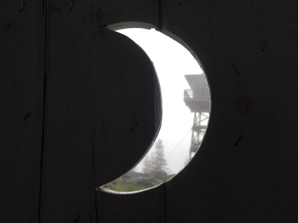
Last night, and the next, would be at civilized lookouts. Towers put up 30 feet on wooden beams for a safe view over the pines, however tall they might grow. In the Yaak these towers have been maintained enough that they are officially tourist approved, and we tourists reserve and pay for sleeping in them. Tonight would be in the second class of lookouts, older cabins, with wrap around glazing but also on ground level. This one had been built up, presumably by chipper men in black and white, on a dry foundation of the 80 pound blocks that formed this, the highest summit for 50 miles. Paint flecks lay flailed off by the recent winter, and the close interior had two wires running corner to opposite corner. The wind accelerated as I laid down with plenty of evening light yet to spend, and I fell asleep, gusts circulating in the open door, and the wires visibly tensing and relaxing as the building continued against the wind, 9 years to go til its second century.


I woke up the next morning rather later than expected, and in spite of or perhaps because of the uninterrupted 12 hours of sleep knew I had spent myself the day before, in a way that one or even three nights of food, water, and rest would not fix. A problem with lookouts is wrapped up in their appeal, that above the 45th parallel and a few days past summer solstice the sun rises at 440am and sets at 11pm. Ones eye is sent inwards as readily as to the horizon, contemplation of neither being especially easy on sleep. The next morning I’d get another break from sunshine, with rain and fog rolling in and my soul softened with accomplishment. But that morning it seemed I would do well to make miles while things were high and cool.
The day passed as a waking dream, as days deep beyond fatigue on a backpack often do. Less than a week later my mind recalls snatches, moments bright with mosquito bites or jagged steps, and blanks into a green blur in between. For the final miles I knew the last lookout was poised on the ridge ahead, but for the trees I could never see it.

I find that important trips are put in order after the fact, as memory filters back from the hinters, and reexamination of maps, photos, and blisters sticks them to the ground. As sap, or perhaps mud. The 20th century logic of lookouts strung lines of sight across the land, mountains which could see as many crannies as erosion would permit, and by design or coincidence each other. For two days I walked two sides of a triangle, on nearly every occasion the forests permitted able to see at least two, often three, of the places I would sleep. If that older logic organized a world only recently less than infinite, my 21st century logic wrung mystery from between the roads. And from the final lookout I could see none of them. Not the paved ones along the creeks, nor the slinking one which caressed its way up to the trail, taking the folds as if water running in reverse.
That afternoon I took off my shoes and finished the book I had carried, chin down and back to one of the windows with which I was surrounded. A quick glance left for the deft pinprick of the first lookout, stark on a hill who at this distance appeared simple and symmetrical. Another glance, just ahead, for the second, a dot glazing the highest point of the ridgeline whose subtlety was for the miles lost entirely, the lookout not existent save for edges just far sharp from anything the patient wind would have made.

Leave a reply to samh Cancel reply