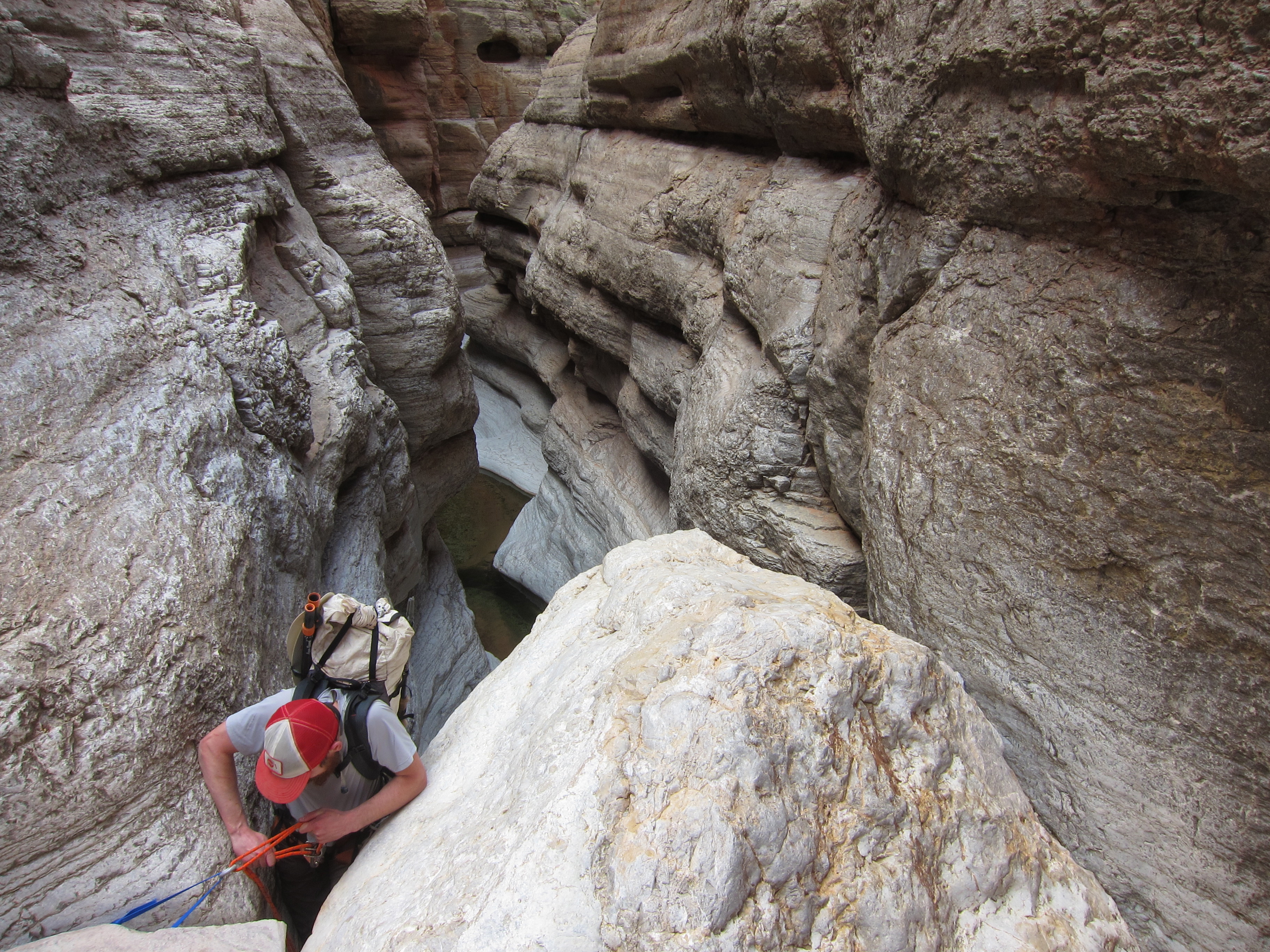
Waking in a narrow defile was a great way to start the day. As was the case every morning of the trip, it took a little encouragement to stand up and get the legs and feet functioning normally. We immediately rapped the short chockstone drop, did a few more downclimbs, and popped out of the Redwall slot into a more open wash.

More gravel walking, more cobble hopping, more downclimbing through and around big boulders.
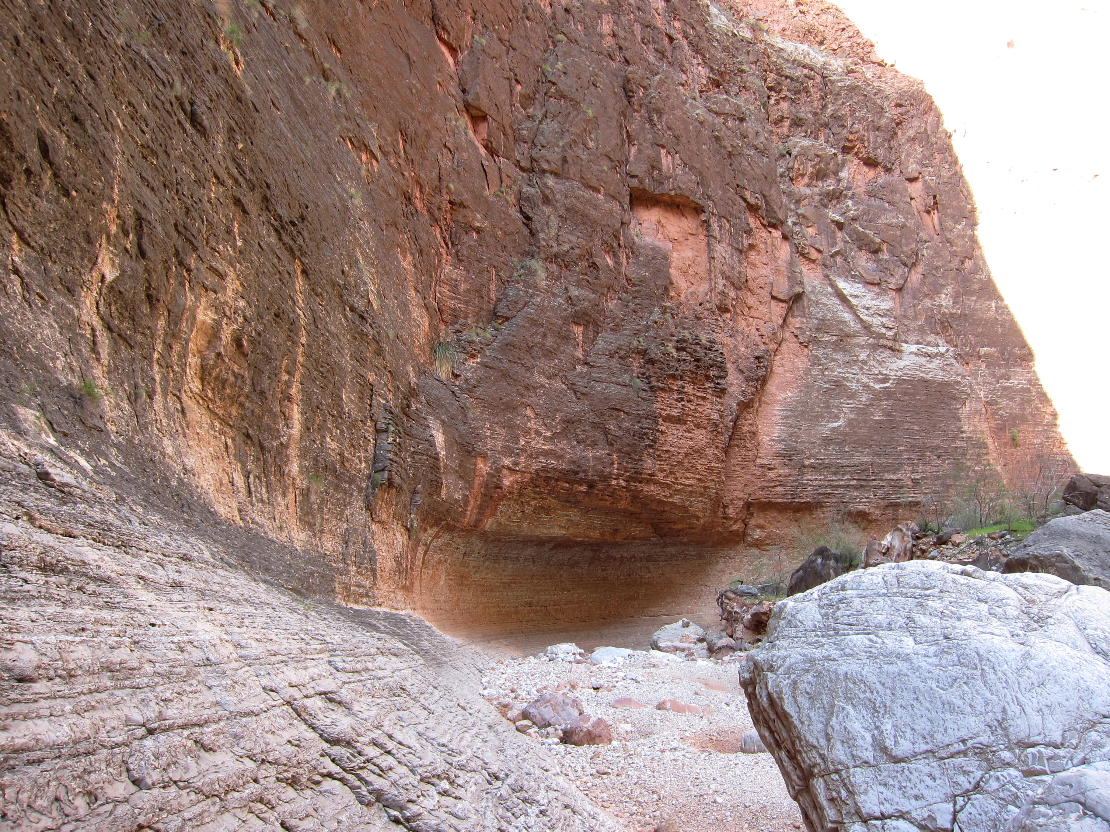


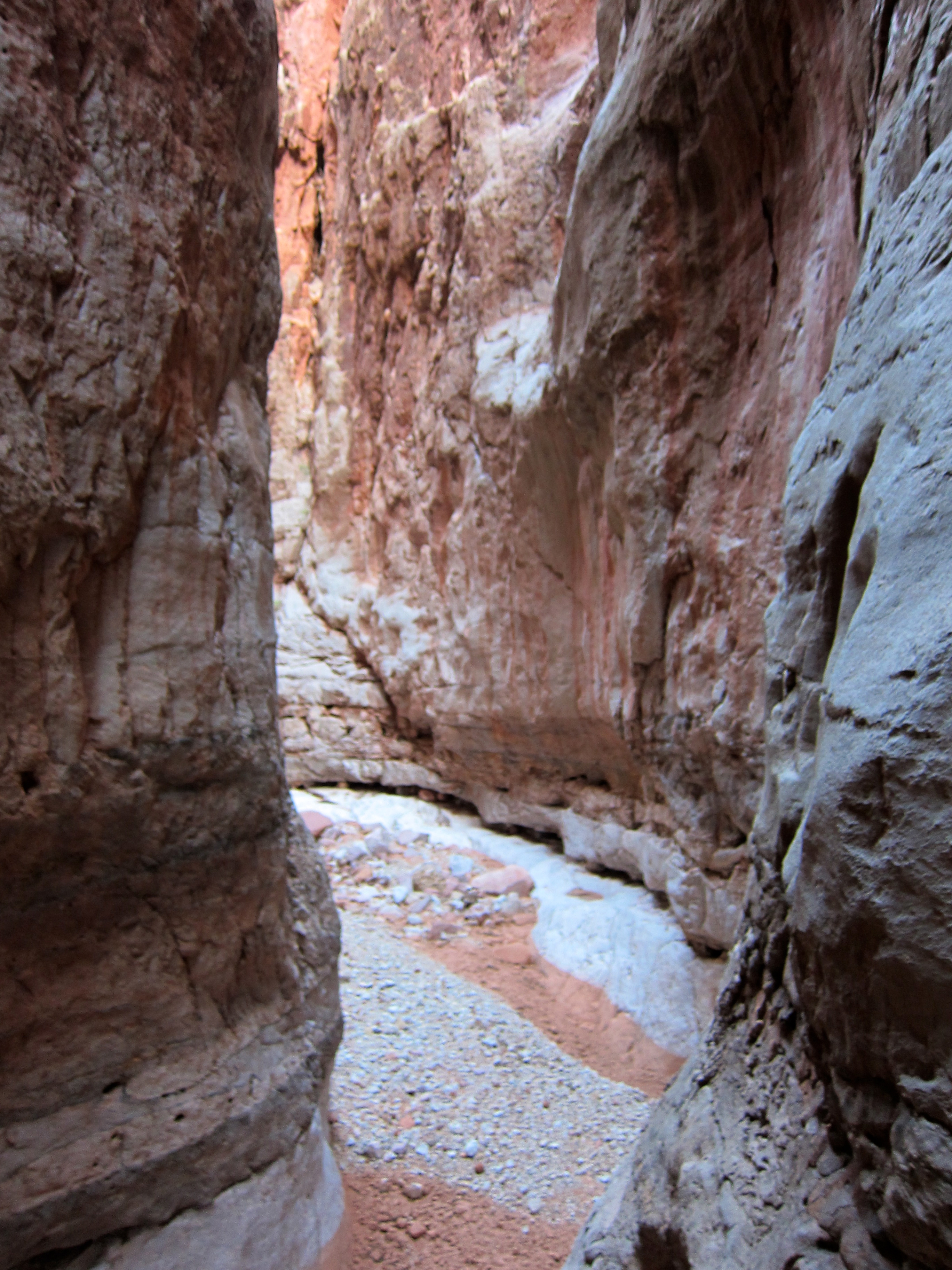
Olo wasn’t the gobsmacking technical canyon the guidebook and various ‘net reports seem to suggest, but it was a sublime and rugged drainage. The alcoves were big, the walls done in a subtle kaleidoscope of tans, whites and auburns, and the lower section alive with sudden short bedrock slots and flowing water as clear as the highest and most remote mountain stream.


We were already ahead of schedule, and the morning shade made temperatures very pleasant, so we took our time.


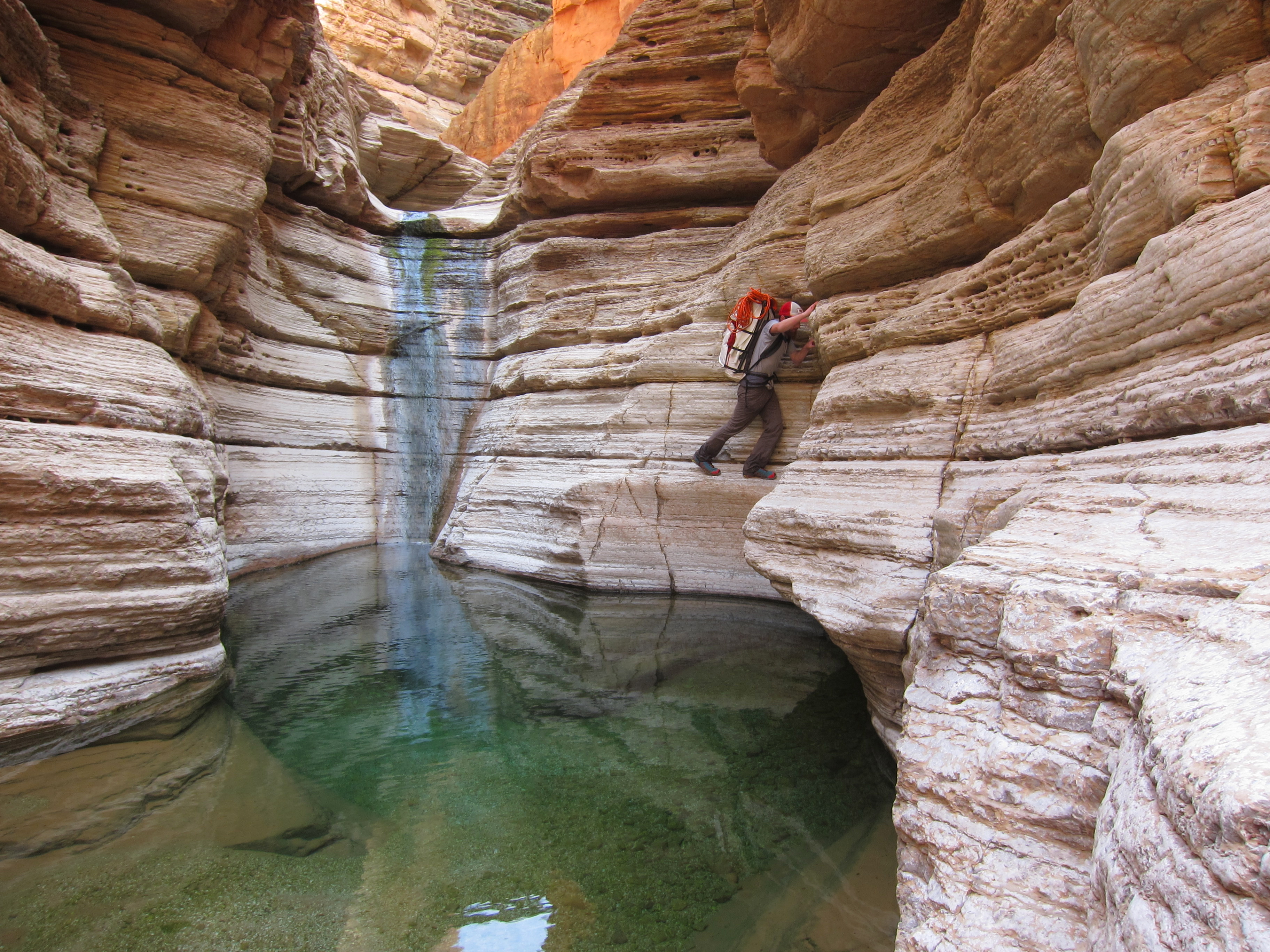
The ropework was modest, and the water surprisingly warm(ish).

A rafters route up some sketchy-looking rock accesses the hanging bowl below this rappel, but the narrows above can only be gained by a very long walk; something which should serve to keep Olo’s aura mostly intact.

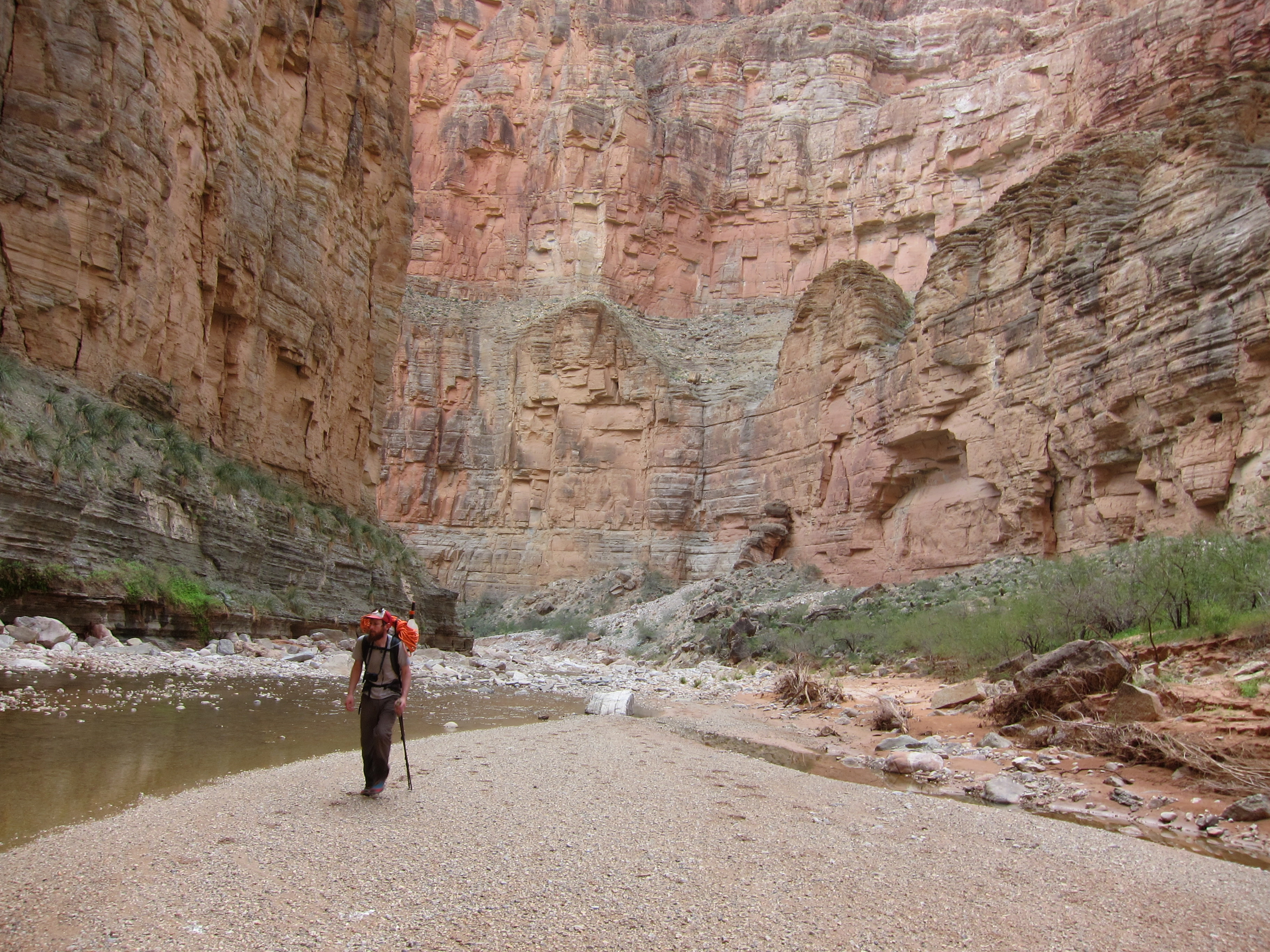
Once back at the river it was time to leave the confines of the soon-to-be classic Matkat-Olo loop, which involves descending and then ascending 150. Instead we headed two miles upriver, with more beach walking and talus hopping.

It was warm out.

We found a good packraft crossing back to the north shore. Unlike the Matkat crossing, which is as placid as one could imagine in the Grand Canyon, this crossing had some good eddy lines to cross. Brendan shipped some water and learned the hard way about leaning downstream when peeling out into the current.

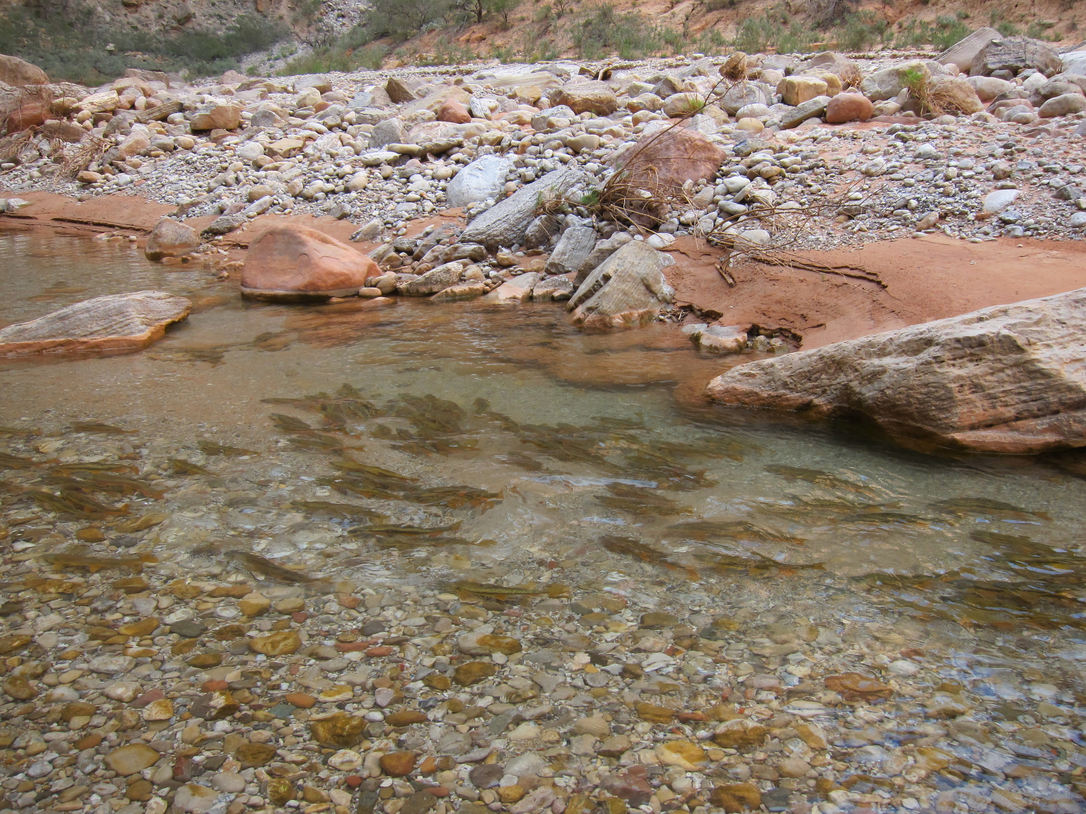
Soon enough we were walking the beach and then up the stream into Kanab Creek. Flannelmouth sucker were spawning, which provided unexpected entertainment. Aside from burros, tons of birds, and lots of sheep shit, this was our only wildlife of the trip.
Kanab vies with the Little Colorado as largest side canyon in the Grand Canyon, and the massive, twisting lower reaches would qualify for national park status on their own.
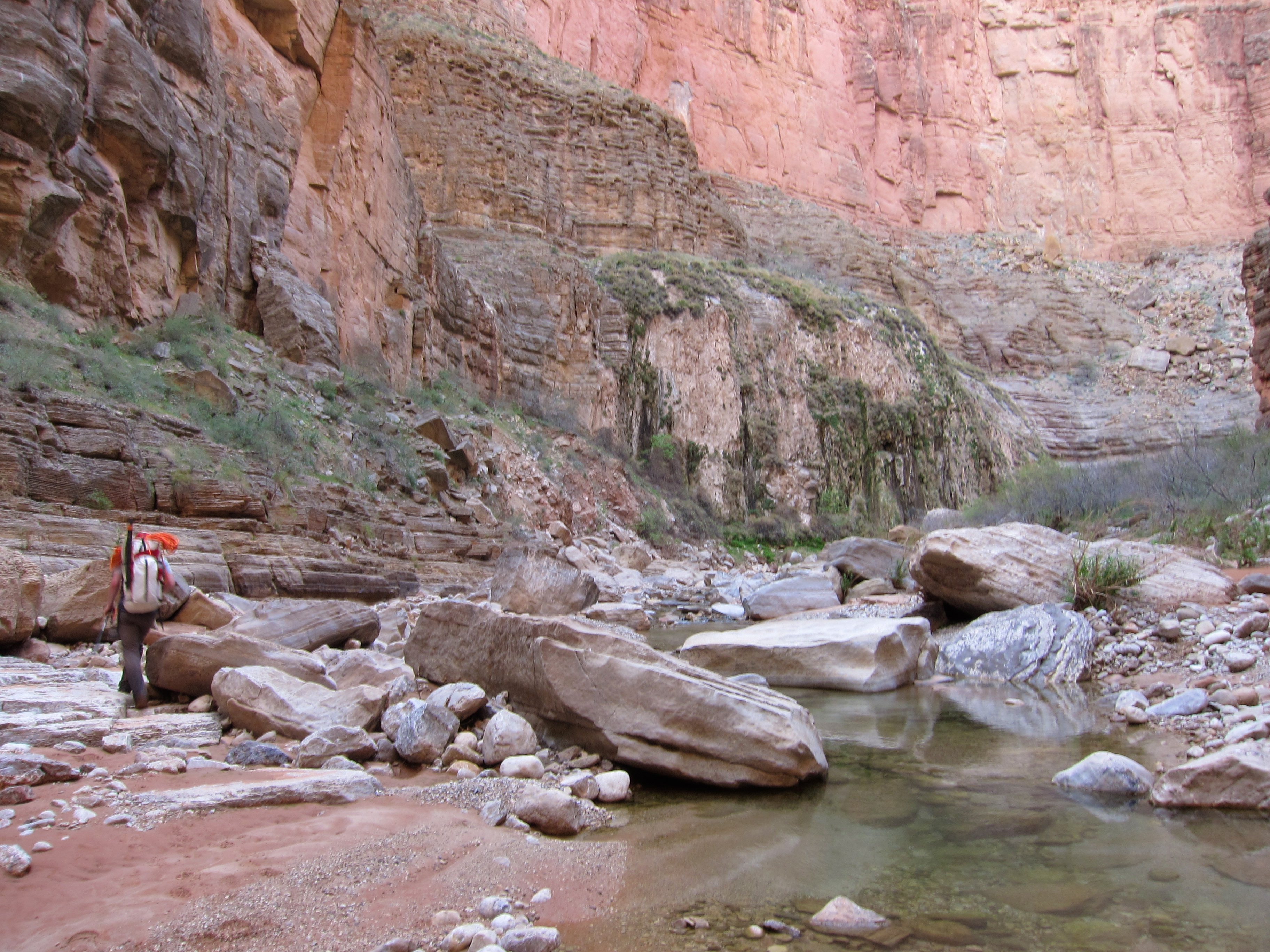

The lower few miles have enough established gravel bars to provide pretty fast walking, but soon enough things get more serious, and the going slow. With too many boulders, it’s hard to find a line which maintains a rhythm. We just kept going until it got late enough to stop, then collapsed on the first convenient flat bench.
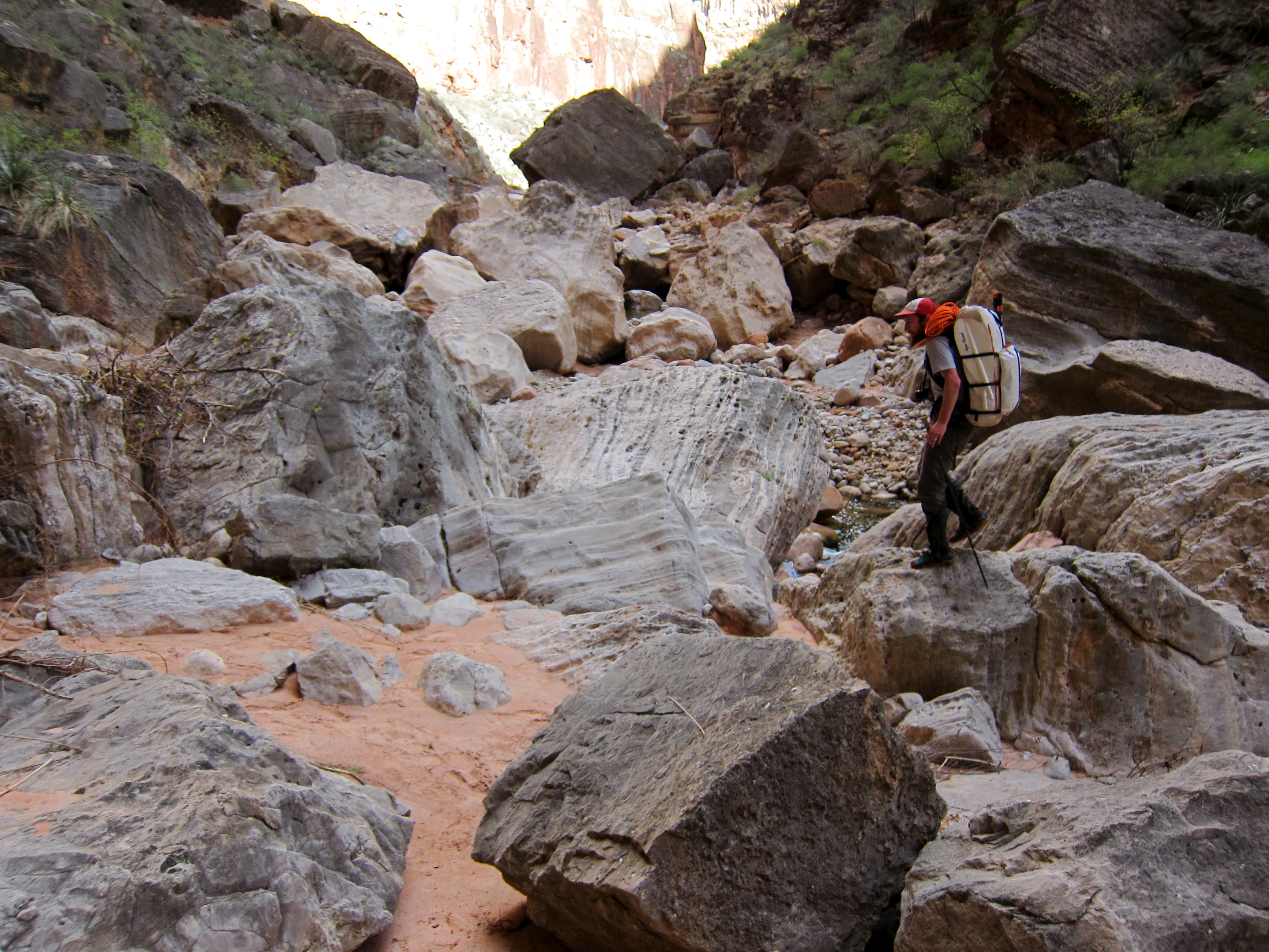
The going was even tougher the next morning. The middle reaches of lower Kanab feature a few WTF sections, where office building sections of the walls have collapsed, creating mazes of house sized boulders through which the way is not obvious, and the only options strenuous. After three full-on days, we were feeling the accumulated effects, and it was quite obvious that fatigue was not going to abate. We were too deep in debt, and the remaining terrain too likely to remain unforgiving. We would also have to do the toughest section twice, as our route had us ascending Kanab again to climb out Scotty’s Hollow in the final days.

Showerbath Spring provided one of the more startling sights of the trip, with the radically undercut hanging garden pouring mineralized water.

An obviously full-power flood had rolled through in recent months (we assumed last September), depositing fresh debris well above the normal high water mark, and rejuvenating the plant life. Perhaps the user route through the central sections had been more plain before that.


Eventually the stream disappeared into the gravel, and while we had easier walking, we also had 7 liters of water on board. Based on Olo and Matkat, it seemed reasonable to assume that we’d find water in Indian Hollow, but with a long way to go, it seemed imprudent to tempt fate. Adding that water weight to still heavy packs and tired legs slowed us a fair bit.

The inner canyons, with their limestones and clear water, didn’t feel like the Colorado Plateau I know. Late in the day, we got above all that, into sandstone ledges, cottonwoods, and (of course) plenty of water. We even did a jumpstart, cooking dinner near a nice waterhole around 1700, before tanking back up and hiking for another two hours. Of course, the nice sandstone ledges on which we camped had seeping water nearby, complete with loudly mating frogs. While we may have wasted energy hauling water for most of the day, at least we could drink our fill without fear.
That night marked the turning point of the trip. While plenty of difficulty and unknowns still lingered, unless bad luck intervened we were obviously going to finish the route, and on the short end of the projected time frame. Days were left until the finish, but the distance was now firmly quantifiable. As had become our custom, we fell asleep under the stars shortly after dark, and slept long and hard.

Leave a comment