
I started my outdoor life hiking, and to hiking I will always return. It has been as constant as just about anything else in my life.
Glacier is an important place in my life. Decades ago during that first visit we did what most people do; hike the highline, play on the pebble beach at Apgar, see St. Mary Lake, and hike down to Hidden Lake.

No doubt there are a number of Hidden Lakes in the northern Rockies, just like there are a lot of Cabin Creeks and Bridalveil Falls. Common names don’t, or at least shouldn’t, take away the potency of a warm haven during a hard winter, the memory of a family member back east, or the result of a long summer exploration, the moments after which these landmarks were presumably named over a century ago.

My only memories of that first visit to Hidden Lake are of marmots in the rocks, the thin and precise gravel beach, and the mountain goats walking along said beach, refusing to move around us as we sat fishing. My mom said the mosquitoes were horrid, and we left far sooner than my isolated but vivid memories would suggest.

There were no bugs this past weekend; just fast clouds and a wind that had us wishing we brought gloves.

We were lucky. Mom had called back in the winter and lucked into one availability at Sperry Chalet. I wanted to get there via the Floral Park traverse. She taught me to hike and backpack three decades ago, and I wanted to show her what I had done with it since.
Floral Park isn’t the hardest dayhike in Glacier, but it’s pretty well up there. The ascents are steep, the descents steeper, and while the off-trail section is fairly short, the constant attention you must pay to both the scene and your footing wears quickly.


I took pains throughout the day to remind mom that we had plenty of time, and that going slow to go fast is the way to do these things. Constant, efficient steps with all possible energy saved, and no injuries, is the method of choice.
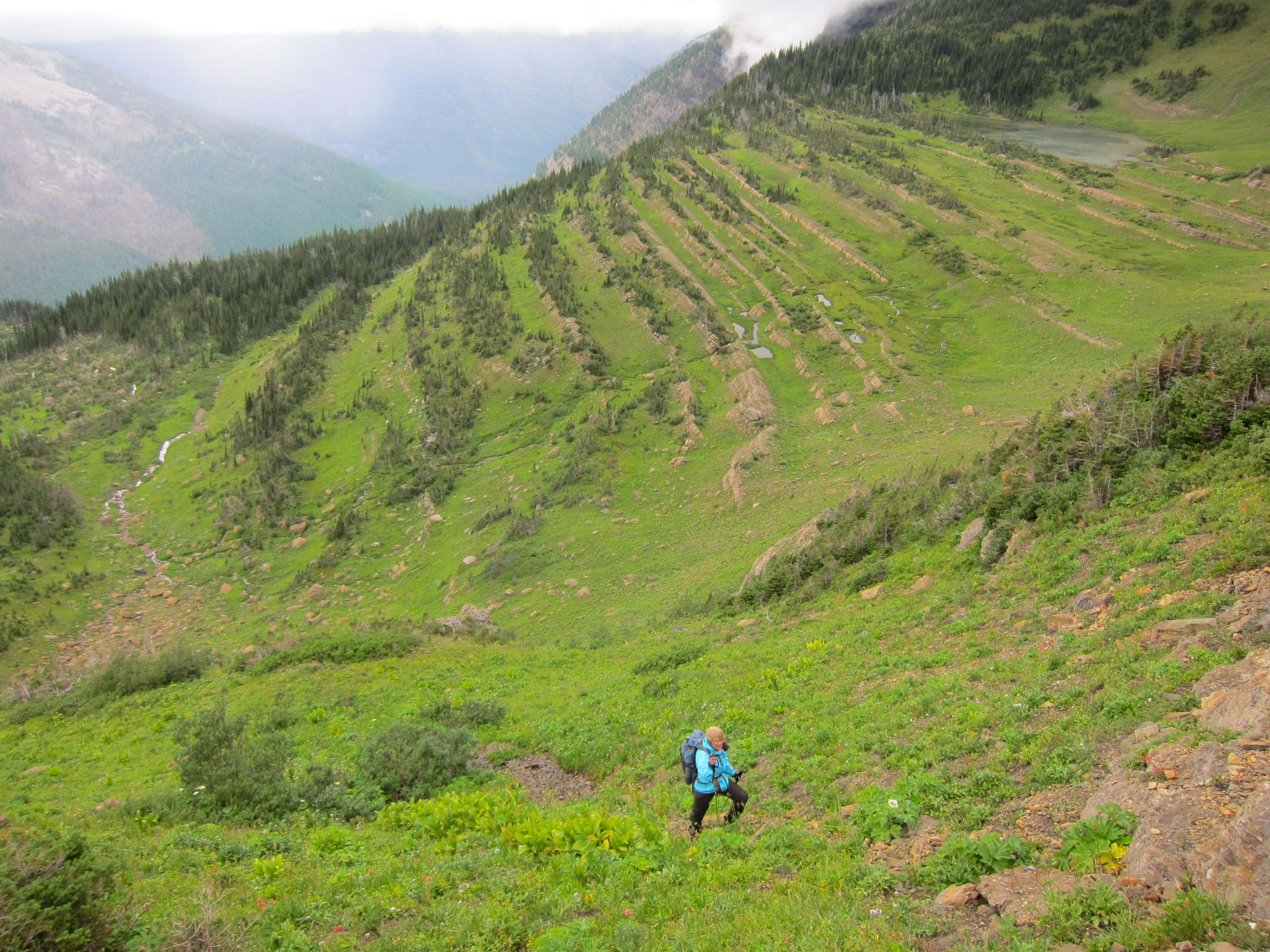
When it rains on the 40 degree beargrass, deliberate foot placements are no joke. The fibrous stalks mimick a slip and slide very well indeed.

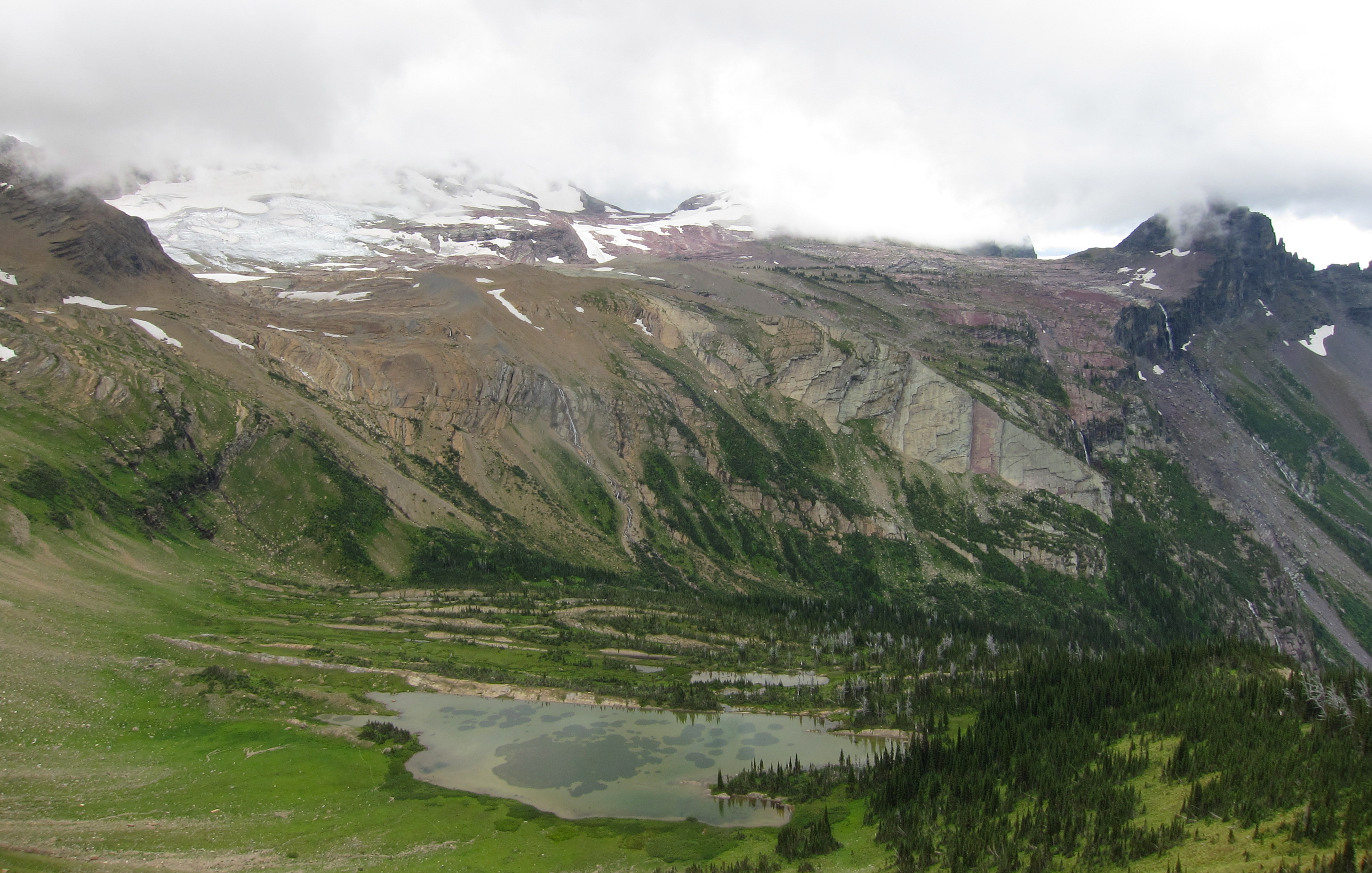
By early afternoon we were in the glacial basin itself, the highlight of the trip, and walking over the wreckage Sperry built as it retreated.

We took the easy way, walking over the toe of the glacier itself, which is a great way to see the varied ice and snow and the weird formations therein. I brought a pair of microspikes, which my mom appreciated.

Unfortunately I did not also bring my crampons, and we ended up wanting them. The usual exit from the glacier is in late summer a short (~70 meters), gentle (25 degree max) slope up to a rock buttress. A prominent cairn on said buttress is visible for most of the walk across the basin, a tantalizing marker of civilization. Unfortunately the lower and steeper half of the slope had melted down into bullet ice, and with a few crevasses below, going up without spikes was a bad idea. Alternating and throwing down the microspikes also seemed a poor choice. Precise throwing does not run in the family. So we were obliged to take the alternate route, skirting around the far side of the basin until moderate rock and snow slopes lead up to the pass.
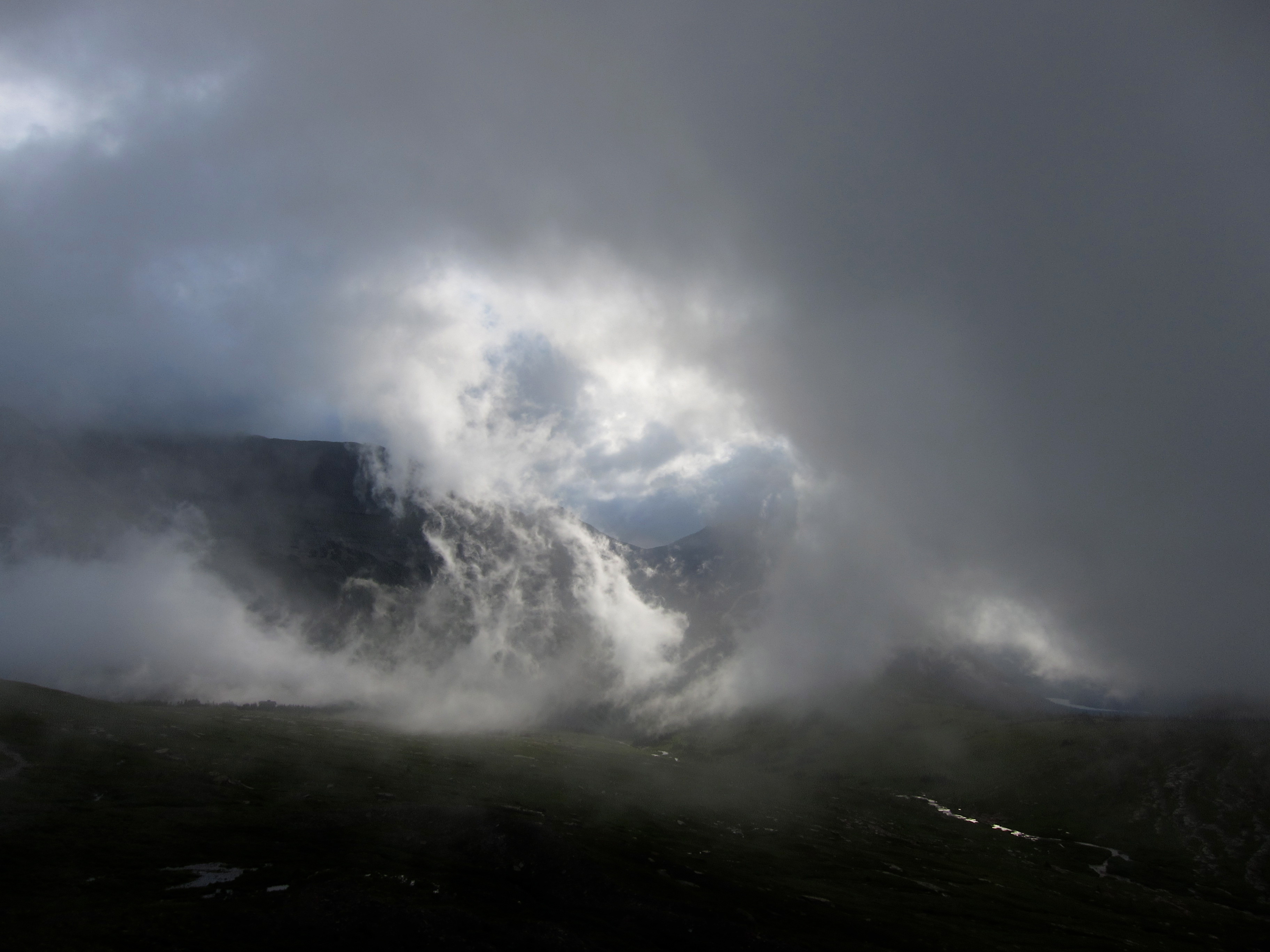
This is when shit got real, and the occasional fog and drizzle we’d had most of the day closed down to intense rain, 100 meter visibility, and eventually sleet, hail, and snow. Nothing to do in those situations but keep moving, and make extra sure you don’t tweak a knee on the limestone which was now running with water just about everywhere. Mom was rightfully worried, having no idea where the trail was, but if the line between safety and disaster is in these situations most especially thick, it is at least very easy to see.
After some cold wet futzing around, I managed to be on a high point at the right time when the clouds lifted for 10 seconds and the large cairns which mark the trail down to the chalet could be seen. The hour walk down was cold with no hills or even flats to generate heat, but we did have the assurance of a roof, fire, and hot dinner in front of us.

Sperry if the kind of place the national parks need more of. At 7 miles and 3300 feet above road, it’s just far enough out to tempt folks out a bit further than they’d otherwise go. The location is tremendous. The food was plentiful and excellent. The staff, led by my friend Renee, were exceptional. Being there during the first crack of winter into summer made it all the more appropriate and welcoming.


What more can be said, but that it was a good trip?

Leave a comment